


TopoGarden
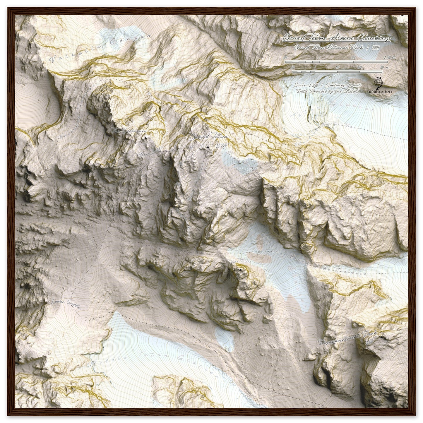
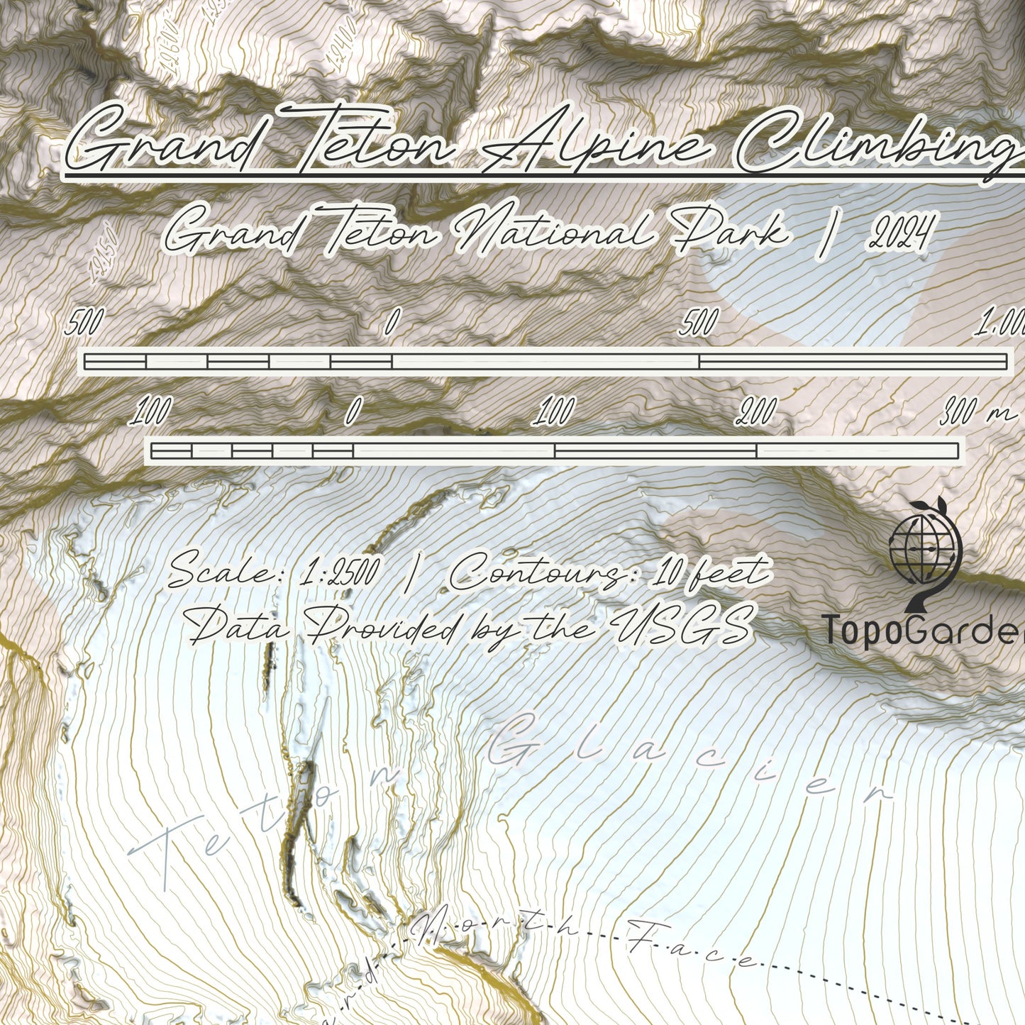
Grand Teton Alpine Climbing Map | Grand Teton National Park | Wyoming
Grand Teton Alpine Climbing Map | Grand Teton National Park | Wyoming
Couldn't load pickup availability
Geological Background
The Teton range is characterized by significant tectonic activity and glacial erosion over millions of years. The peaks, primarily composed of granite and gneiss, date back over 2.5 billion years, forming a notable geological landmark.
Climbing Legacy
Climbing in the Tetons began in the early 20th century with notable pioneers such as Paul Petzoldt and Glenn Exum. Their efforts established the area as a prominent climbing destination, now featuring hundreds of documented routes.
Route Quality
The Grand Teton offer a wide variety of climbing routes, known for their solid granite holds and diverse climbing styles. The area supports a range of skill levels, providing opportunities for crack climbing and alpine long routes.
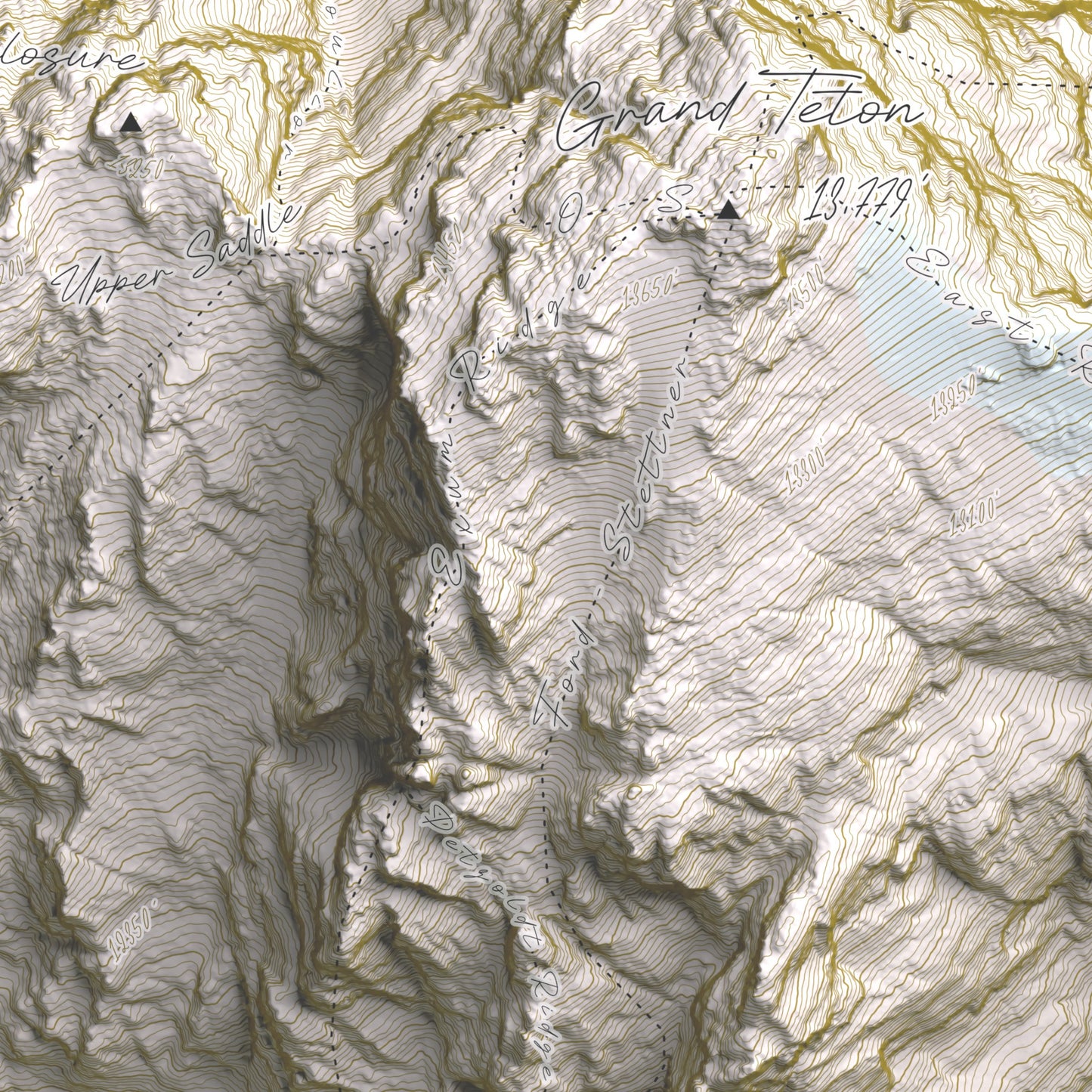
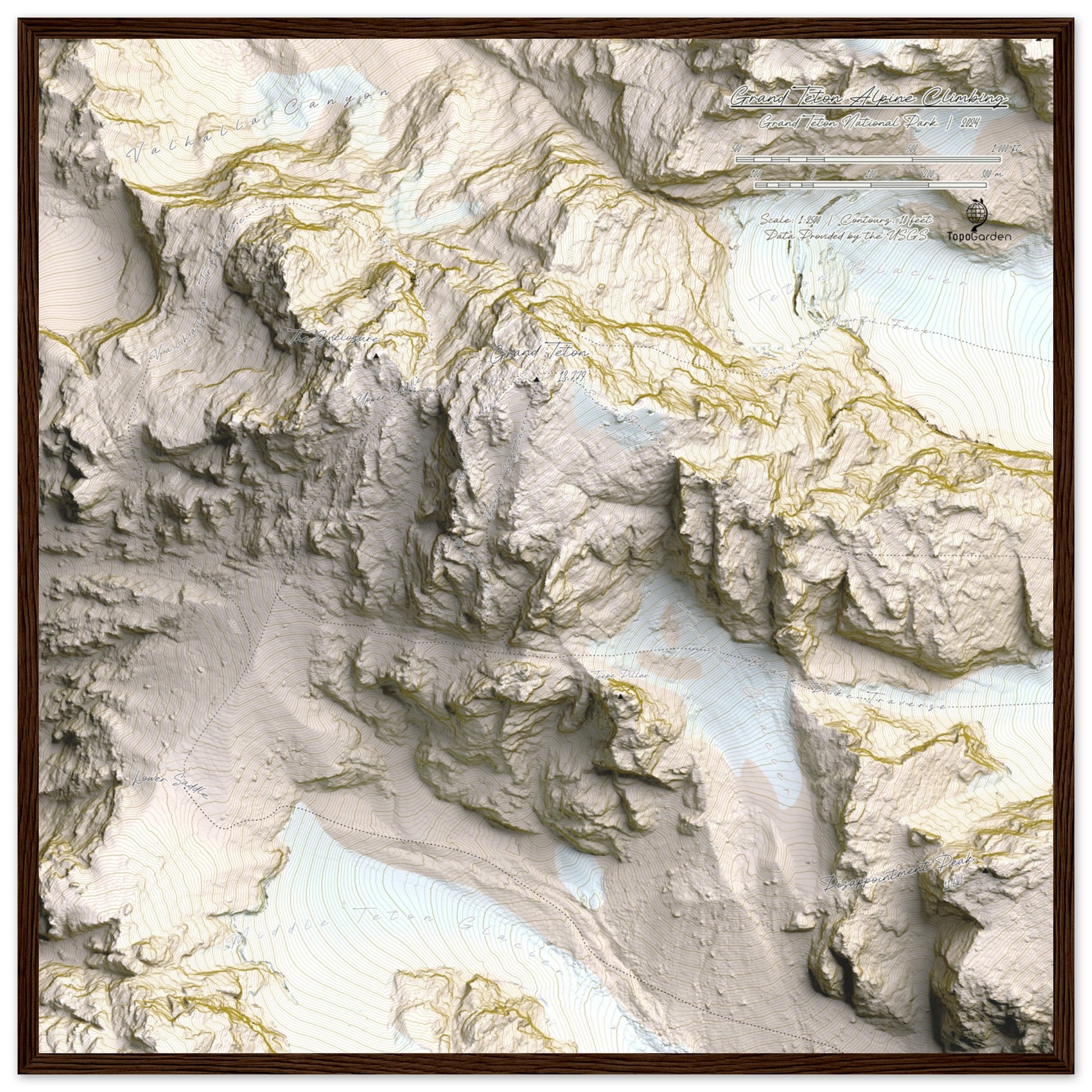
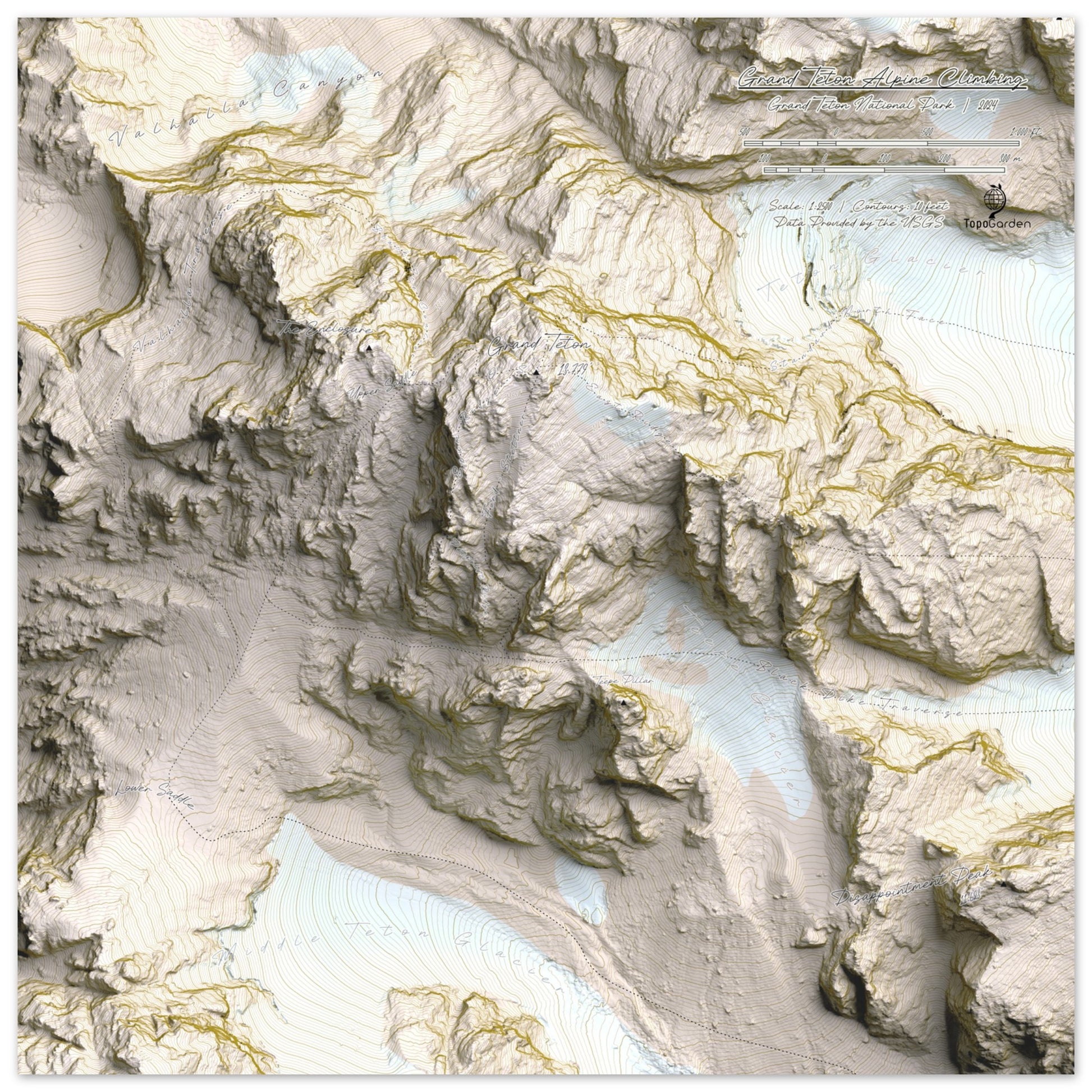
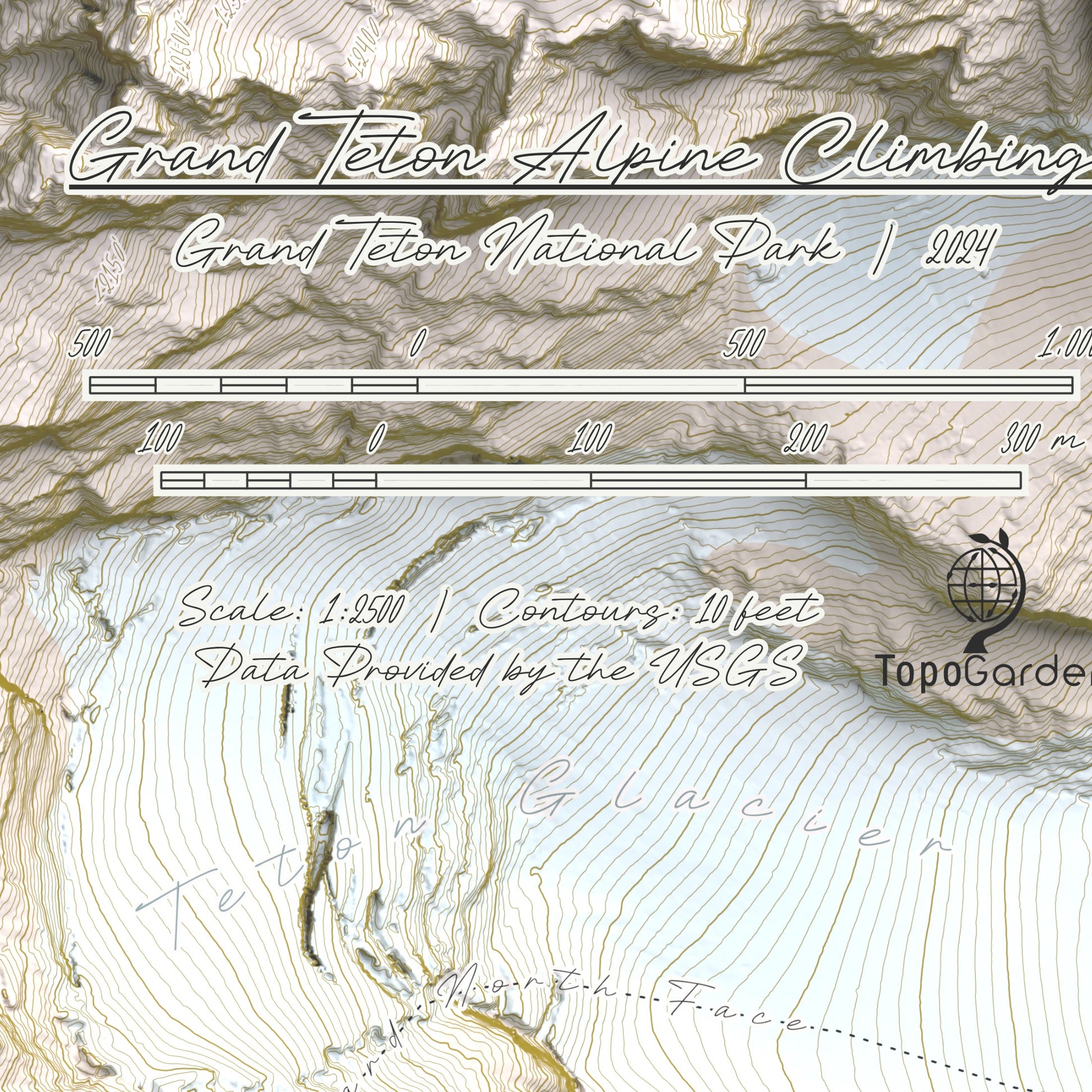
Map Features
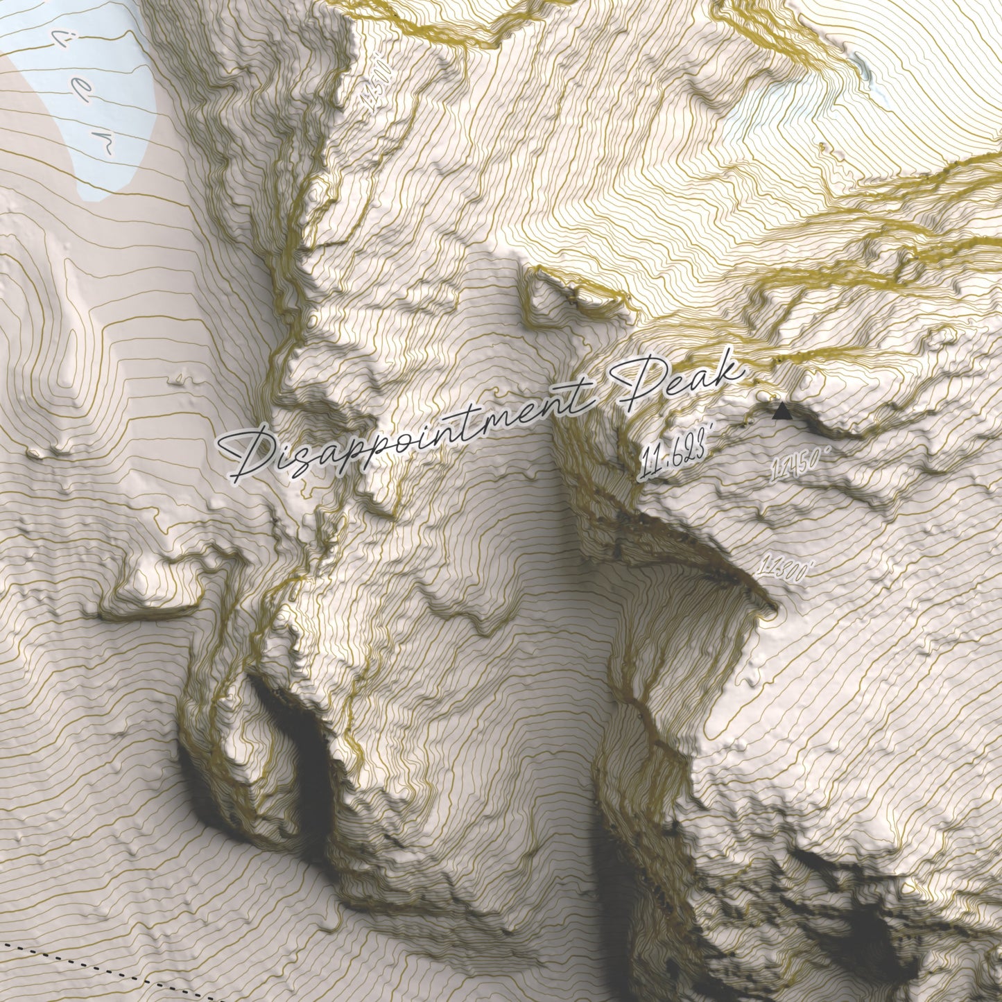
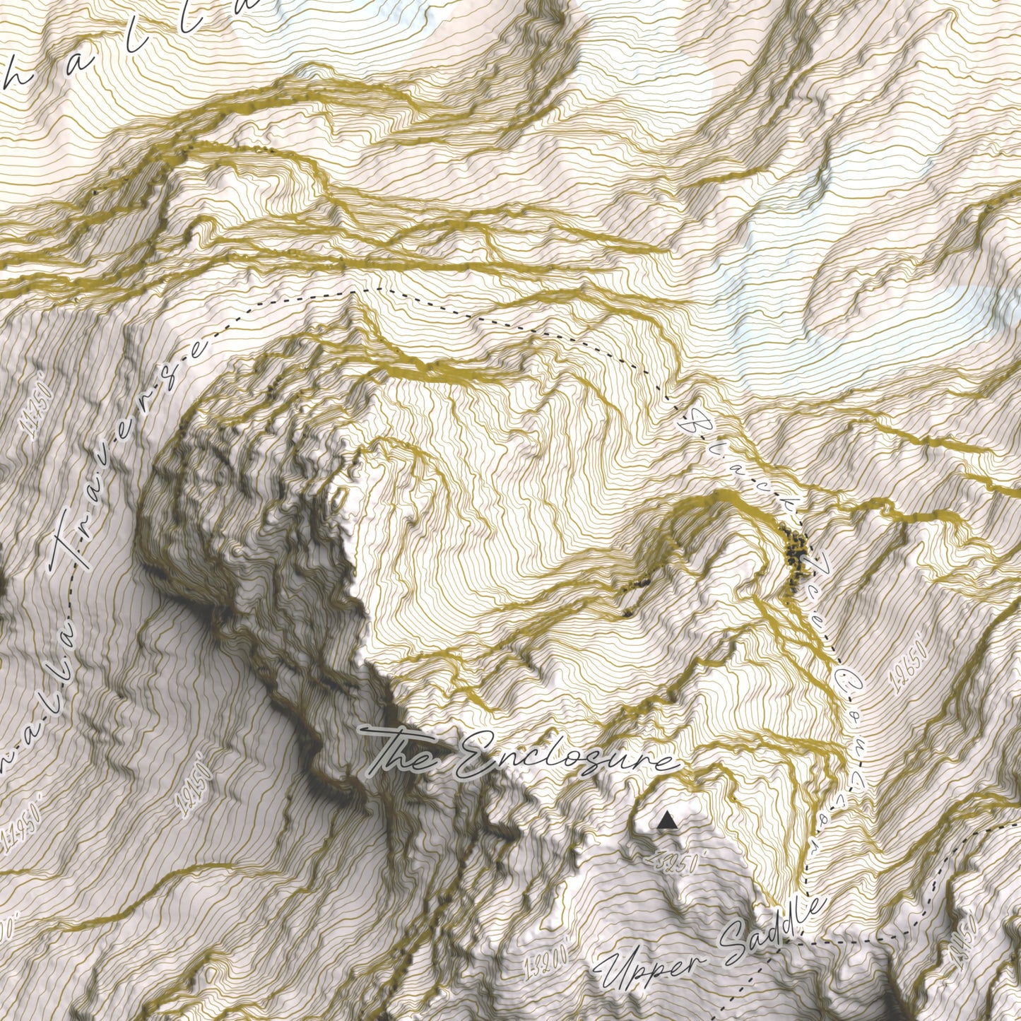
The map of the Grand Tetons includes highly detailed contour lines at 10-foot intervals and precise hillshading, providing an accurate representation of the terrain. Key features and select climbing routes are clearly labeled, making this map an excellent tool for inspiration and a sweet conversation piece.
Print Info
Print Info
- Maps are printed on 200 gsm/ 80 lb paper weight, making them durable and long-lasting.
- Our print partners use Forest Sustainability Council certified paper or equivalent certifications depending on regional availability.
- Acrylic and Aluminum prints come with mounting hardware. Acrylic mounts on all four corners while the aluminum mounts on a cleat.
- Our maps are two-dimensional representations. However, by integrating digital elevation data with advanced rendering techniques, these maps can appear three-dimensional..
Shipping
Shipping
Free Shipping! Your order will generally be at your door in 4-8 business days. Please note that this is an average and not a guarantee.
Hassle Free Exchanges on paper prints!