
Featured Maps:
-
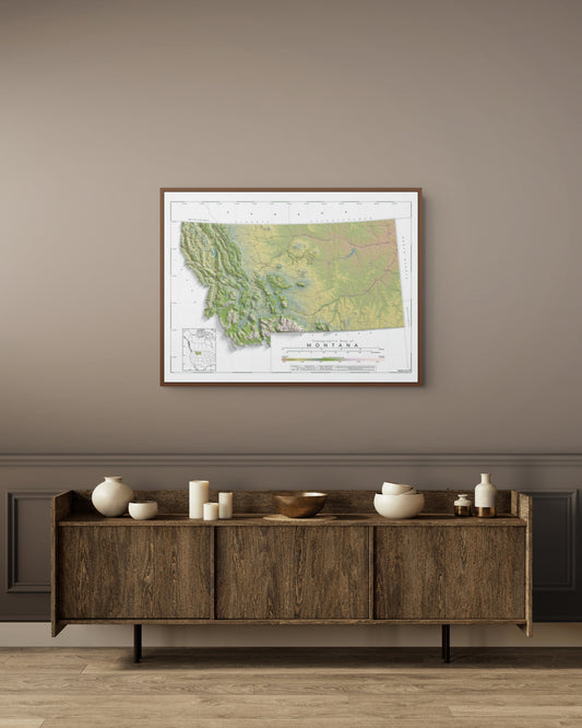
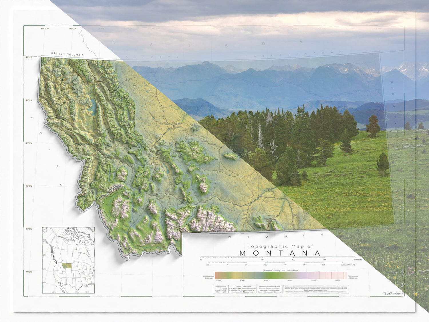
Montana Ranges and Rivers | Topographic Map of Montana
Regular price From $45.00 USDRegular priceUnit price per$0.00 USDSale price From $45.00 USD -
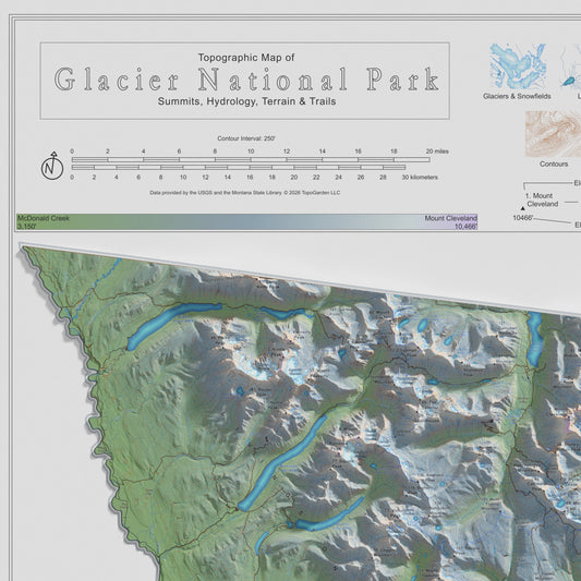
Peaks of Glacier | Topographic Map of Glacier National Park, Montana USA
Regular price From $79.00 USDRegular priceUnit price per$0.00 USDSale price From $79.00 USD -
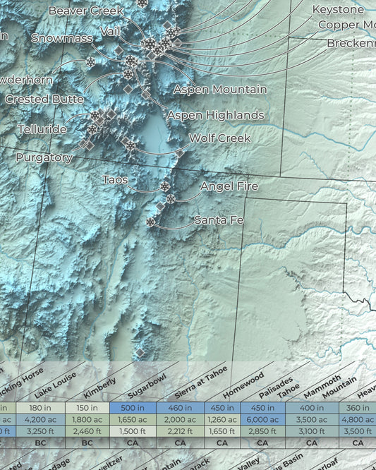
North America Ski Resort Map | 100 Select Ski Resorts
Regular price From $79.00 USDRegular priceUnit price per$0.00 USDSale price From $79.00 USD -
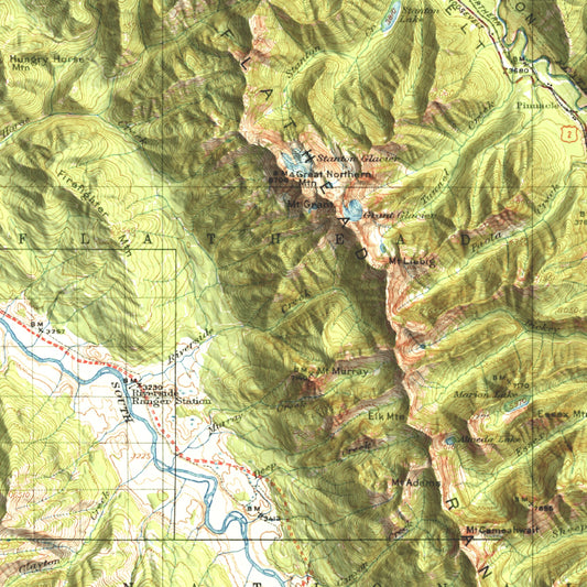
1914 Nyack | Jewel Basin, Flathead Alps & Glacier National Park, MT | 30'x30' Shaded Historic USGS Map
Regular price From $49.00 USDRegular priceUnit price per$0.00 USDSale price From $49.00 USD -
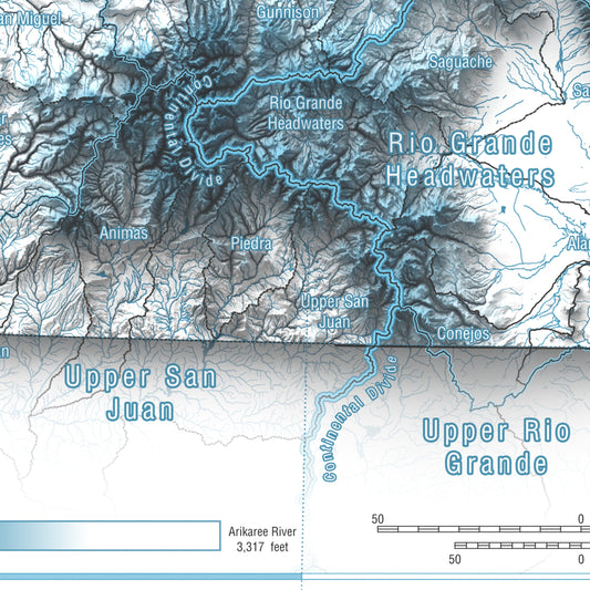
Colorado, USA | Hydrologic Map
Regular price From $49.00 USDRegular priceUnit price per$0.00 USDSale price From $49.00 USD


Reviews From Our Community
Featured Map Collections:
-

Recreational Topographic Maps
This collection includes topographic and terrain-based maps of outdoor recreation areas across...
-

Historic USGS Relief Maps
This collection is based on historic USGS topographic maps, enhanced with modern...
-

Hydrology & Watershed Maps
These maps focus on river systems, drainage networks, and watershed boundaries, built...
-

Antique & Old Maps
This collection features historical and antique maps that have been carefully restored...


Our maps start with research and planning - exploring areas and finding accurate data sources or making our own.
We choose colors and styles for the maps and place all the labels that we want to show
We have our maps printed with top quality materials to ensure long term durability
Why These Maps Exist
I am a nature lover. I grew up in the mountains and spent 6 years guiding educational tours in Yellowstone. I recreate in nature as much as I can, whether that be hiking, skiing, fishing, biking, climbing or other! I studied Environmental Science at Montana State and gained a background in GIS which I've combined with my passions for being in nature.
I, like many others, use maps nearly every day and I tend to obsess over them. We all love maps - they are decision making tools and a great source of inspiration - which is why I created TopoGarden. My goal is to provide practical and beautiful decor, something you can hang on your wall to appreciate, while dreaming of the next adventure.


