Collection: Hydrology & Watershed Maps
These maps focus on river systems, drainage networks, and watershed boundaries, built from hydrologic and elevation data.
They show how water moves across the landscape, making them well suited for regions where rivers, basins, and drainage patterns define the geography.
-
Emphasis on rivers and watersheds
-
Built from raw hydrologic data
-
Minimal styling to highlight structure and flow

-
Montana, USA | Hydrologic Map
Regular price From $49.00 USDRegular priceUnit price per$0.00 USDSale price From $49.00 USD -
Colorado, USA | Hydrologic Map
Regular price From $49.00 USDRegular priceUnit price per$0.00 USDSale price From $49.00 USD -
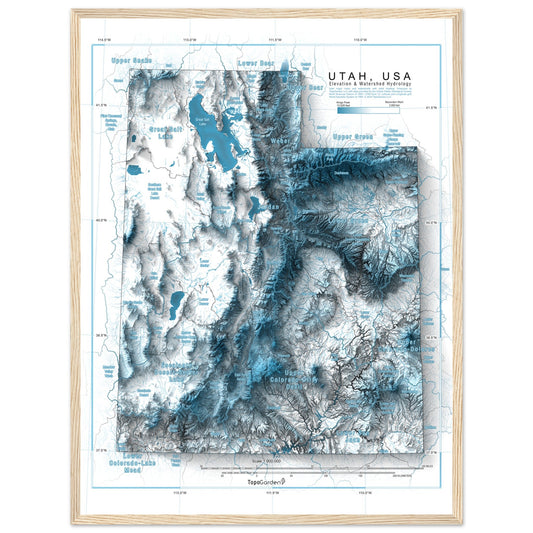
Utah, USA | Hydrologic Map
Regular price From $49.00 USDRegular priceUnit price per$0.00 USDSale price From $49.00 USD -
Yellowstone National Park | Hydrologic Map
Regular price From $49.00 USDRegular priceUnit price per$0.00 USDSale price From $49.00 USD -
Wyoming, USA | Hydrologic Map
Regular price From $49.00 USDRegular priceUnit price per$0.00 USDSale price From $49.00 USD -
Idaho, USA | Hydrologic Map
Regular price From $49.00 USDRegular priceUnit price per$0.00 USDSale price From $49.00 USD -
Arizona, USA | Hydrologic Map
Regular price From $49.00 USDRegular priceUnit price per$0.00 USDSale price From $49.00 USD -
California, USA | Hydrologic Map
Regular price From $49.00 USDRegular priceUnit price per$0.00 USDSale price From $49.00 USD


More Map Collections
-

Recreational Topographic Maps
This collection includes topographic and terrain-based maps of outdoor recreation areas across...
-

Hydrology & Watershed Maps
These maps focus on river systems, drainage networks, and watershed boundaries, built...
-

Antique & Old Maps
This collection features historical and antique maps that have been carefully restored...
-

Historic USGS Relief Maps
This collection is based on historic USGS topographic maps, enhanced with modern...


