


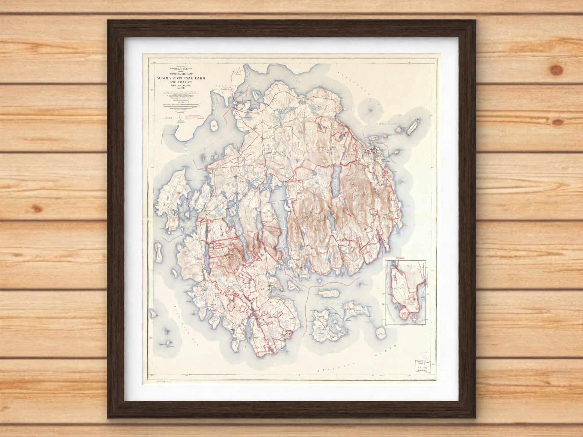
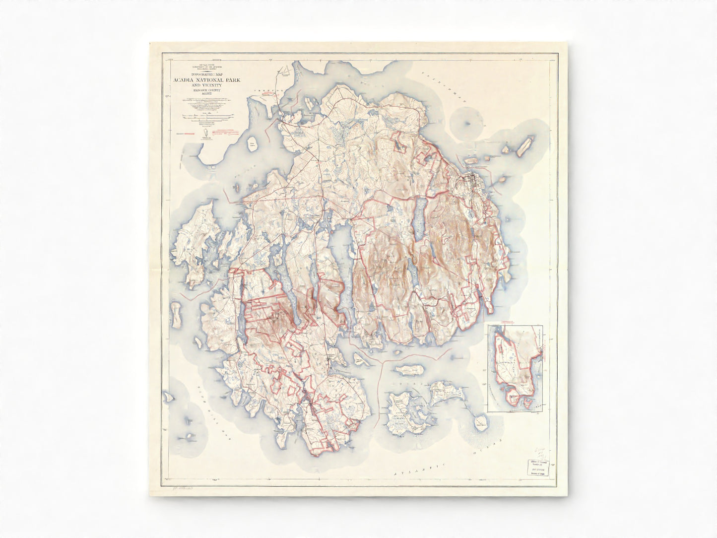
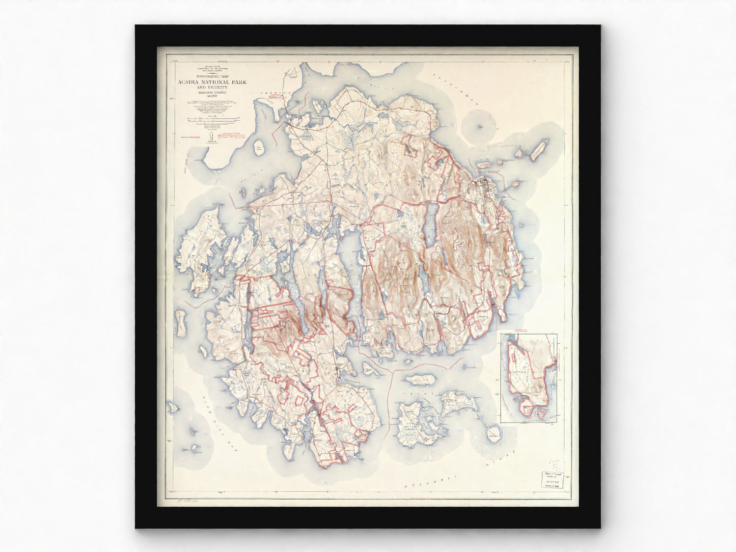
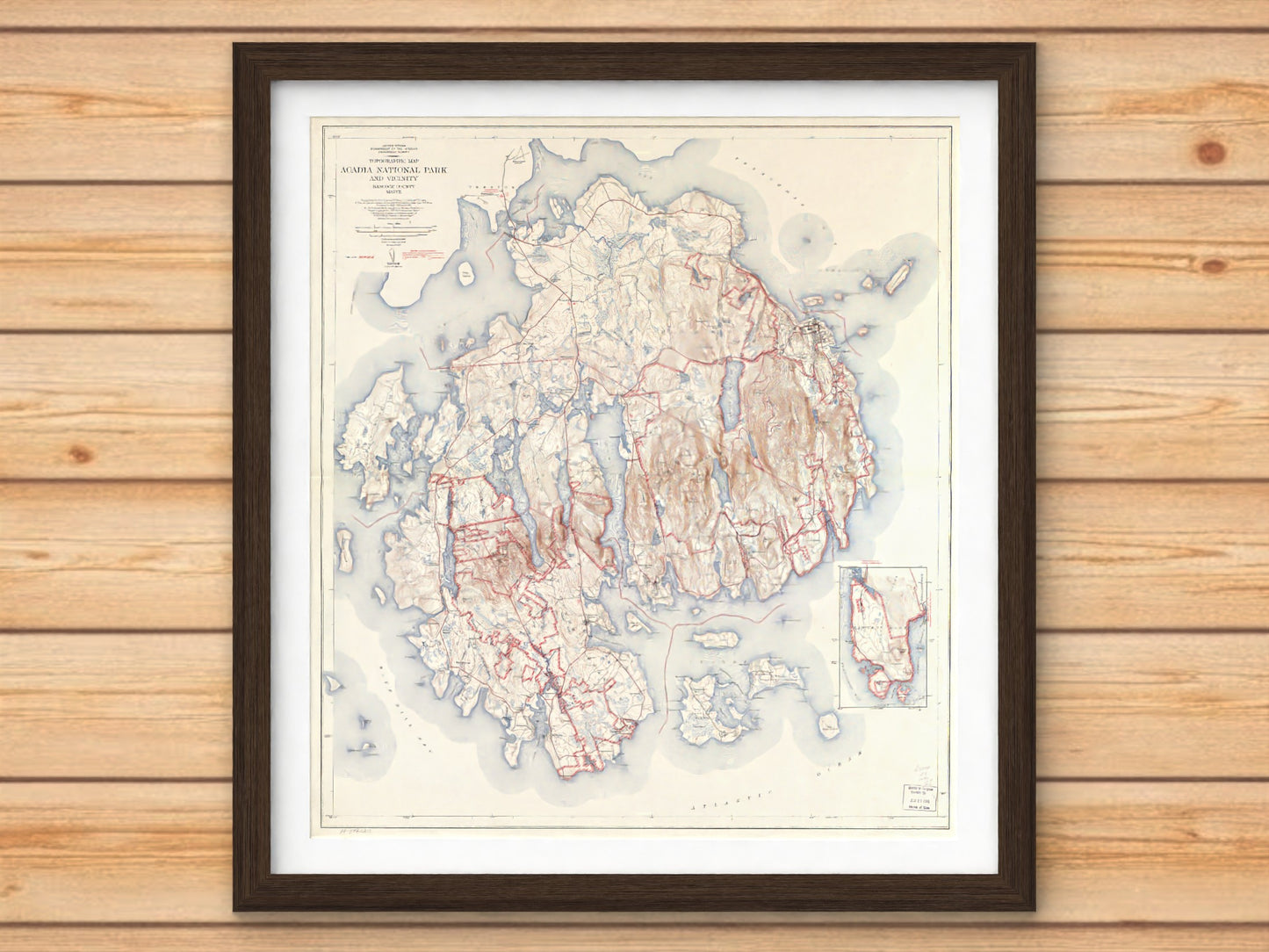
1942 Acadia National Park | USGS Historic Topographic Map
1942 Acadia National Park | USGS Historic Topographic Map
Couldn't load pickup availability
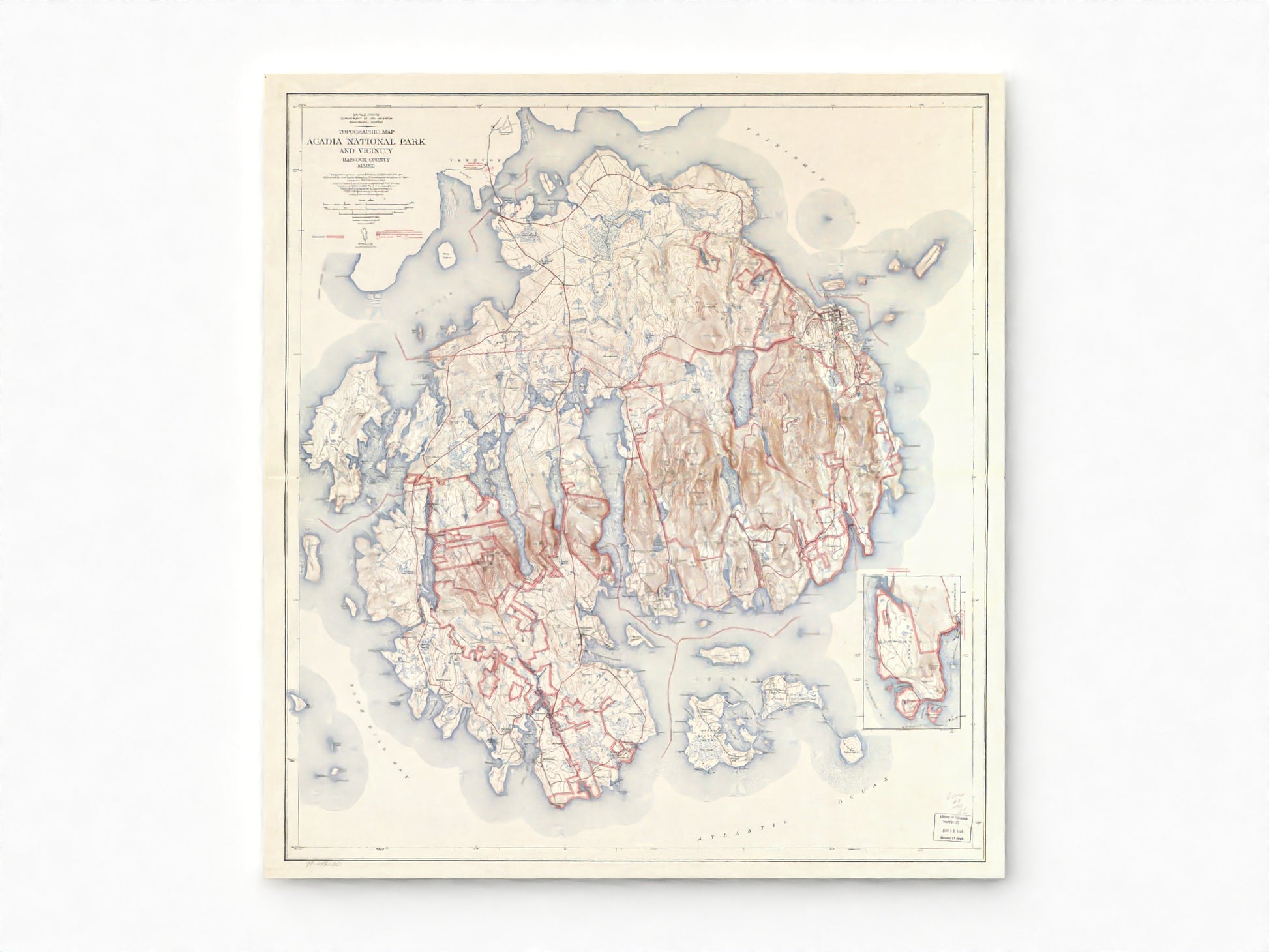
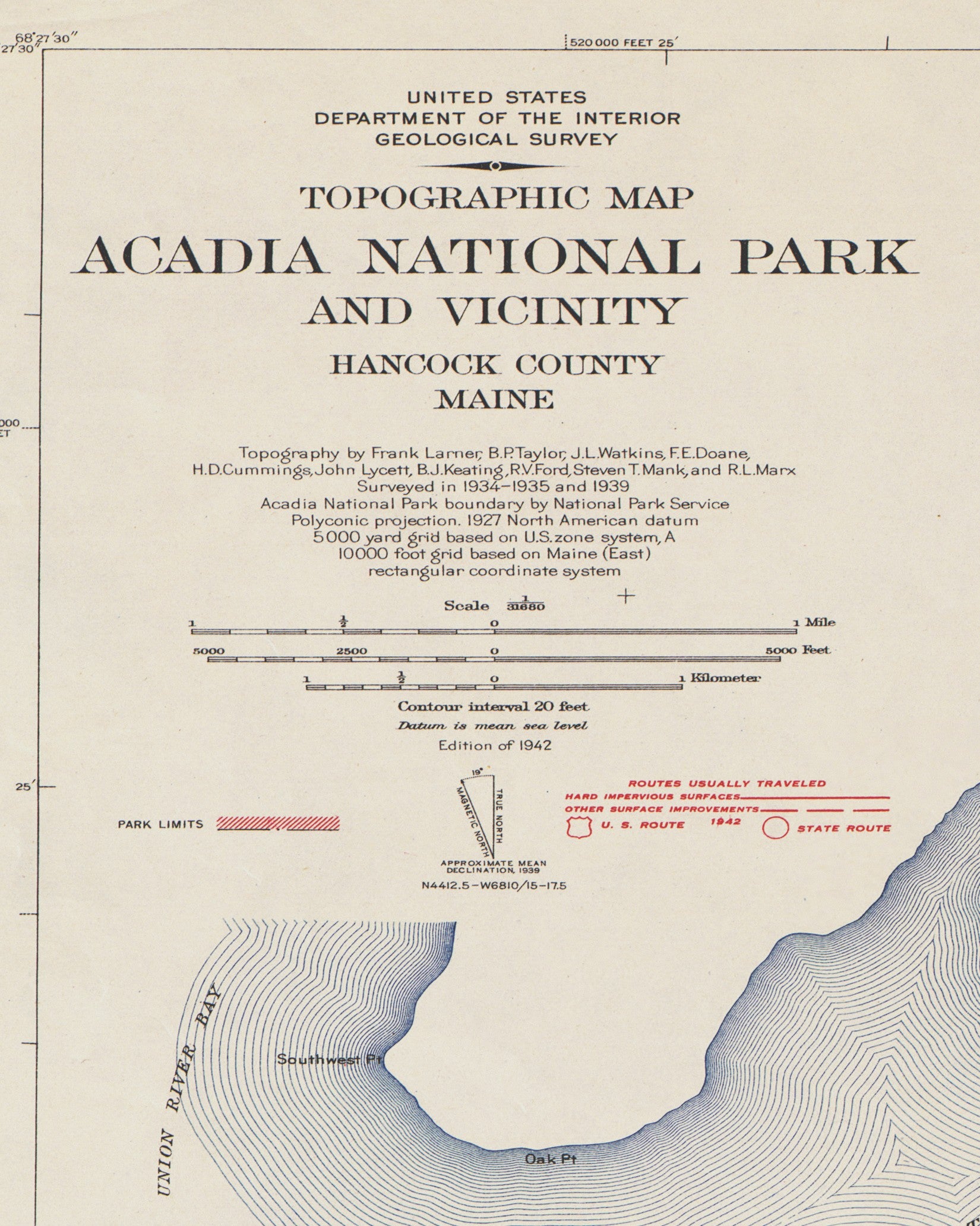
Map Description
Map Description
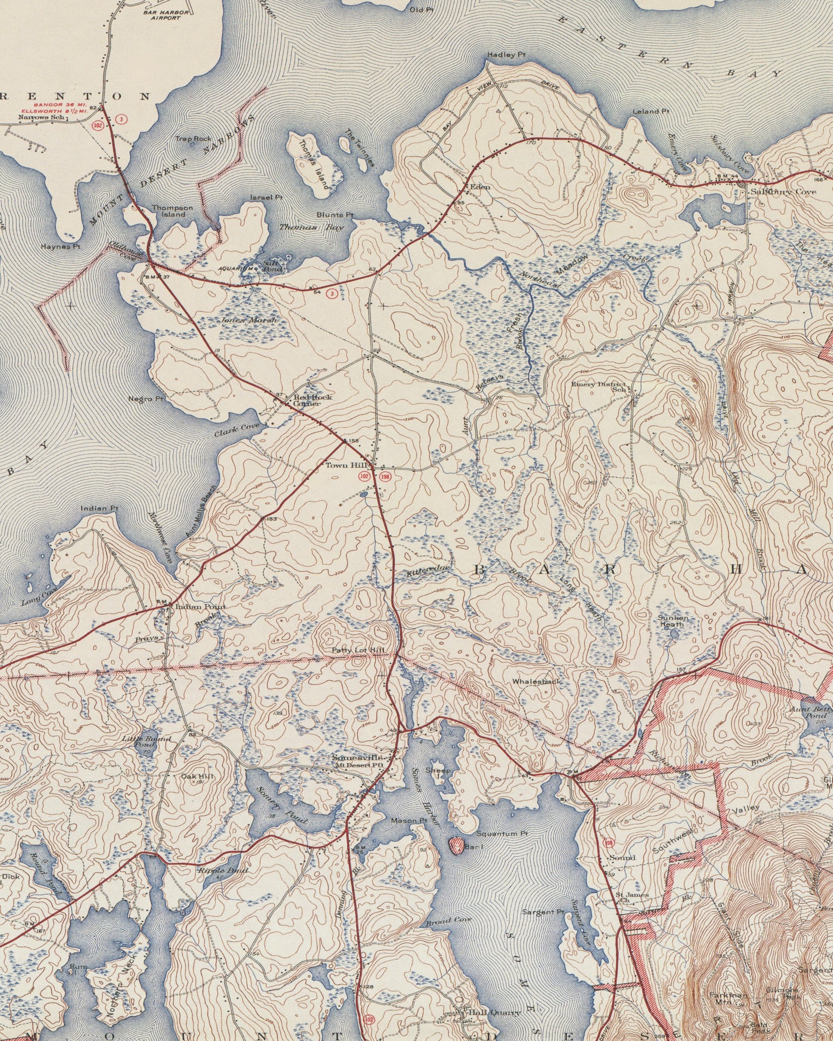
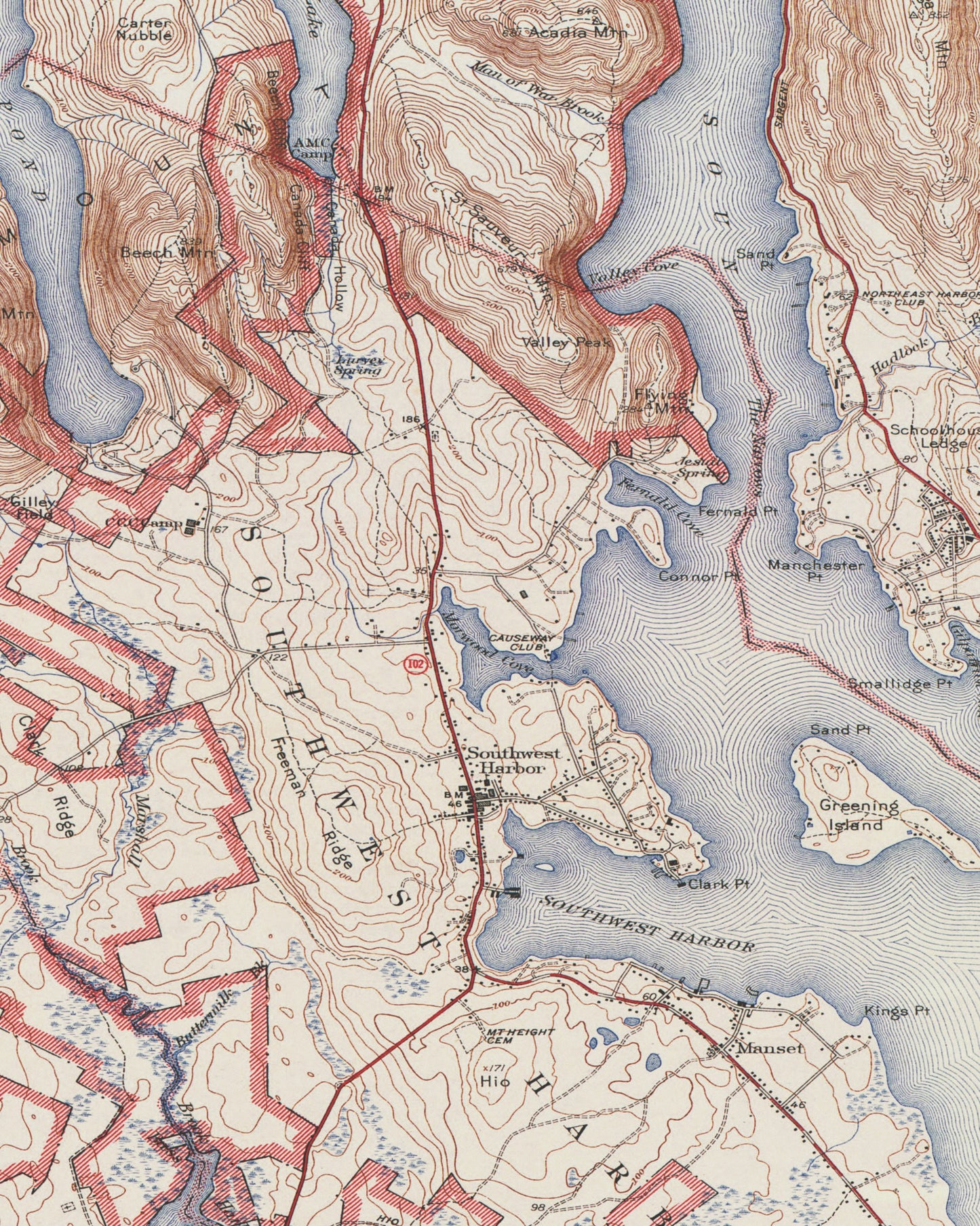
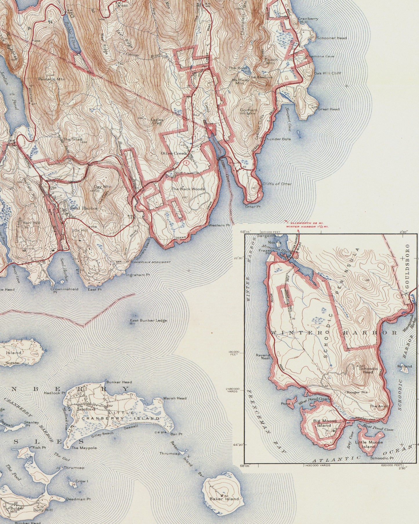
Map Features
Map Features
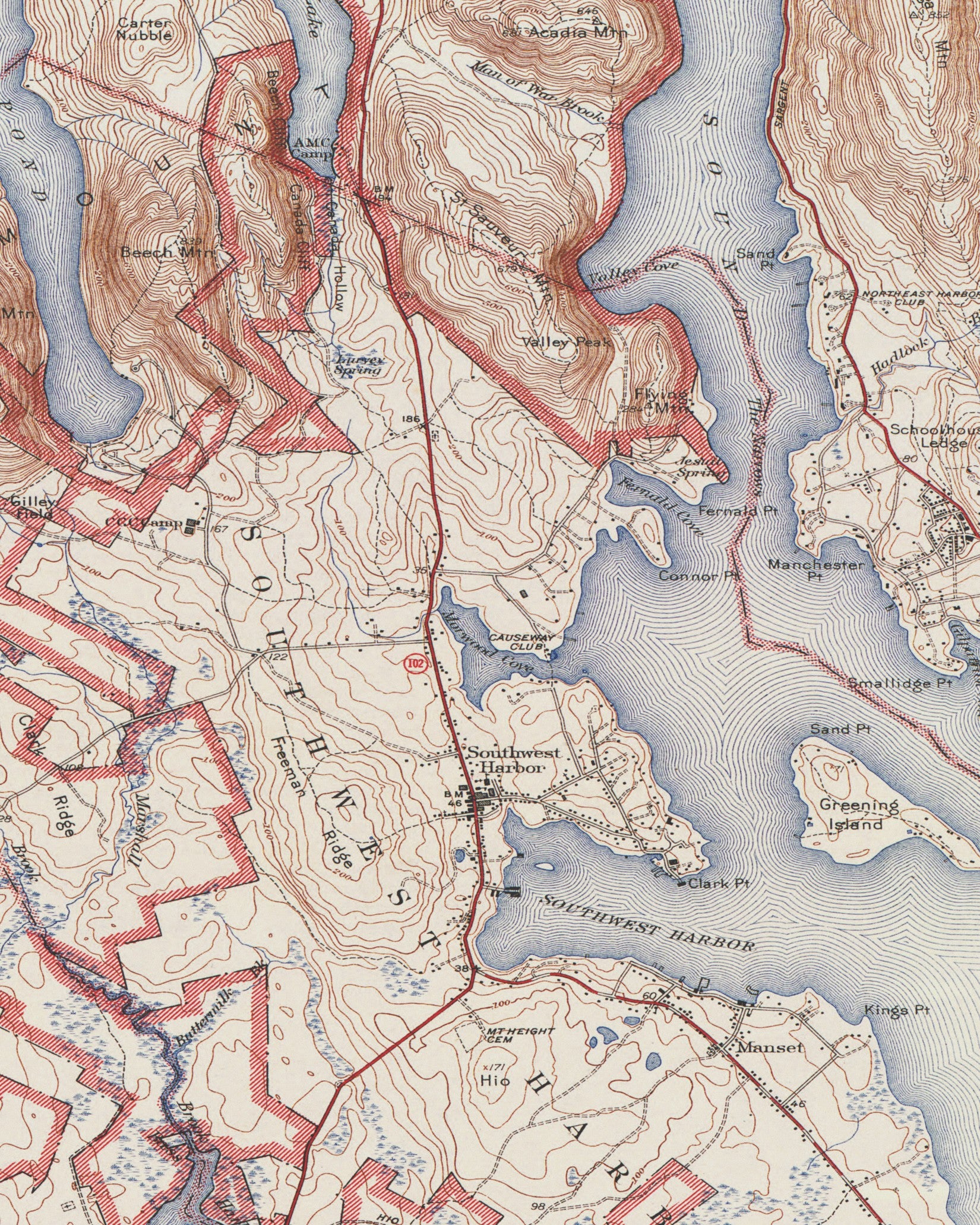
Acadia National Park in Maine is home to a variety of stunning geographic features. Mountains & Peaks: Cadillac Mountain – Highest point on the U.S. East Coast, great for sunrise views. Dorr Mountain – Neighbor to Cadillac Mountain, offering steep hiking trails. Champlain Mountain – Known for the Beehive Trail, a thrilling iron-rung climb. Sargent Mountain – Second-highest peak in the park with fewer crowds. Penobscot Mountain – Features panoramic views and rocky terrain. Coastal Features & Water Bodies: Thunder Hole – A coastal inlet where waves crash dramatically, making a thunderous sound. Otter Cliffs – Towering granite cliffs along the Atlantic Ocean. Sand Beach – A rare sandy shoreline in Maine, surrounded by rocky cliffs. Jordan Pond – A crystal-clear lake with views of the Bubbles mountains. Eagle Lake – A large freshwater lake, popular for canoeing and biking along the carriage roads. Bubble Pond – A small, scenic pond near the base of Cadillac Mountain. Somes Sound – A deep fjard (similar to a fjord), cutting into Mount Desert Island. Forests & Valleys: Beech Mountain and Fire Tower – A forested peak with a historic fire lookout tower. Great Meadow Wetland – A marshy area with diverse plant and animal life. Acadia’s Boreal Forest – Features evergreen trees like spruce and fir, giving it a northern feel. Islands & Offshore Features: Isle au Haut – A remote island that’s part of Acadia, with rugged trails and ocean views. Schoodic Peninsula – The only mainland section of the park, with dramatic rocky shores. Bar Island – Accessible by foot at low tide from Bar Harbor via a sandbar. Other Unique Landforms: The Bubbles (North & South) – Two rounded peaks that reflect beautifully in Jordan Pond. Precipice Cliffs – Sheer rock faces that are part of the challenging Precipice Trail. Each of these features makes Acadia a unique and exciting place to explore, whether you’re hiking, biking, or just soaking in the scenery!
Paper & Printing
Paper & Printing
Gallery Products:
Produced on heavyweight cotton fine art paper with archival giclée pigment inks, chosen to preserve fine details and maintain color stability over time.
- Weight: 330 gsm, 17 mil
- Texture: Very lightly textured
- Brightness/Color: Neutral white
- Finish: Matte
- Giclée Ink Process Resist Fading Up To 100 Years
- Hot Pressed Cotton Paper Preserves Fine Details
Metal, Acrylic and Wooden Prints Are Available Upon Request!
Product Care
- For quick cleaning, dust your fine art paper print with a soft dry cloth or a feather duster.
- Do not display in area with direct sunlight to keep the print from fading over time.
- Framing the print is highly recommended to protect it from damages.
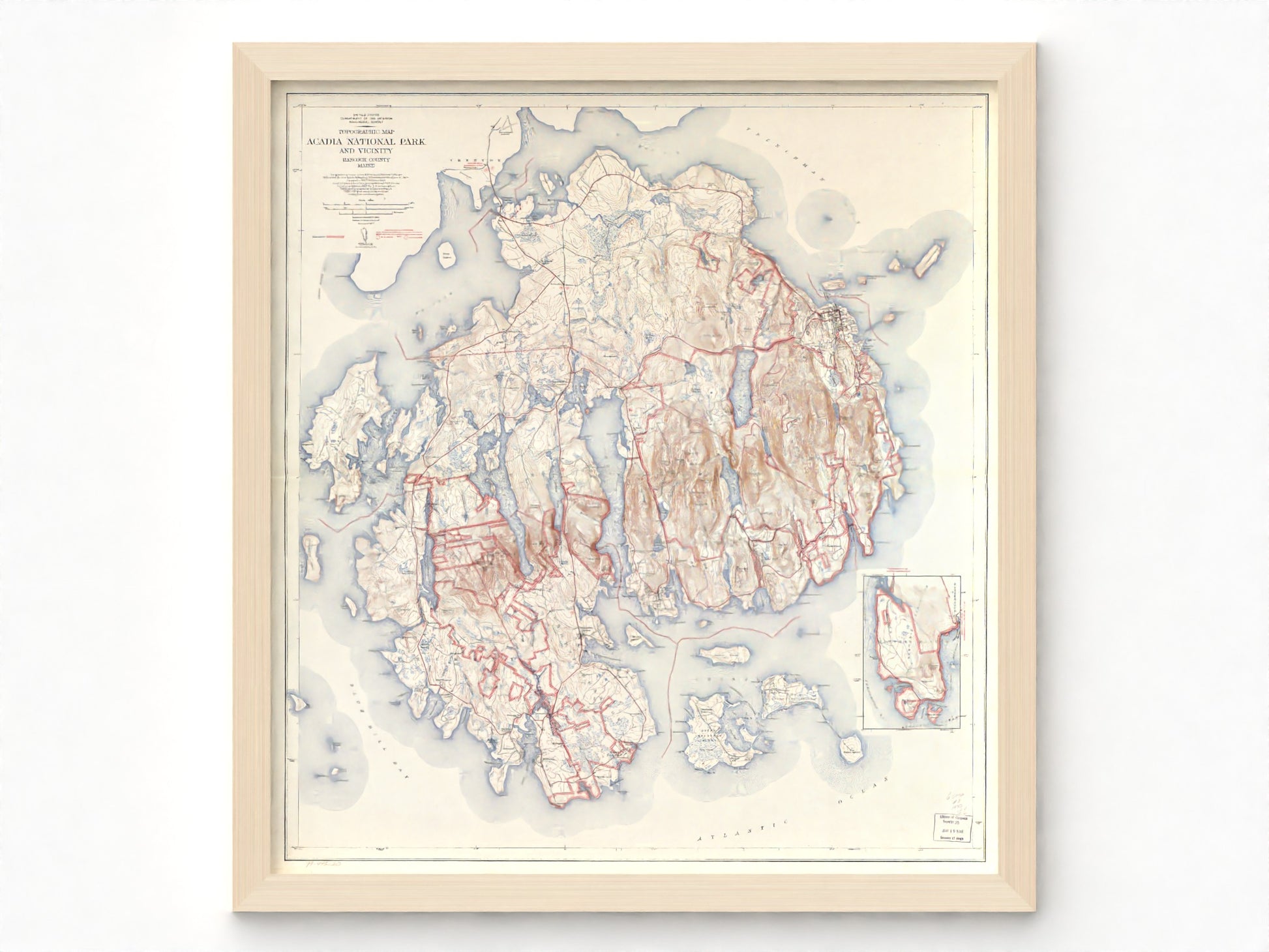
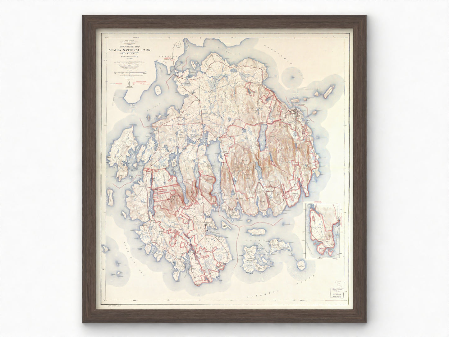
Framing & Mounting
Framing & Mounting
Gallery Products:
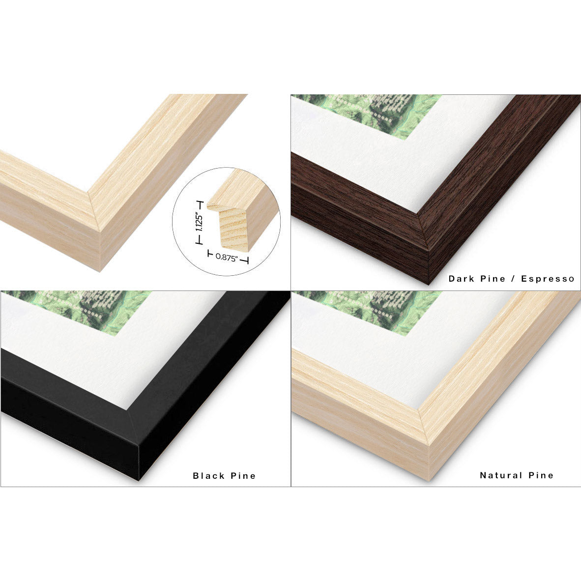
Easy to hang, solid wood frames -designed to present the map clearly and protect it over time.
- Frame + Mat increase both height and width by ~3 inches
- 0.875"w by 1.125"h - Solid Wood
- Optical Grade Acrylic Glaze
- 1" White Mat Border - separates print and glazing*
- Print Mounted to Foam Board to Reduce Warping
- Protective Backing/Dust Cover Installed
- Wire hanger installed
Wall anchors are not included.
* Mats are offered only on prints no larger than 38″ × 58″. Prints exceeding those dimensions are framed without a mat.
If you do not want a mat board, specify in the "order special instructions" found in your cart.
Canvas Prints
Canvas Prints
Canvas
- Thick, Archival-Grade Canvas
- Semi Gloss Provides Bight Colors
- Giclee Ink Process Resist Fading Up To 100 years
- Solid Wood Stretcher
- Foam Core Underlayer for Rigidity
- Wire hanger Installed
Wall anchors are not included.
Rolled Canvas
- For large format prints
- Not ready to hang
- Shipped Rolled and can be stretched or framed by the purchaser.
Framed, stretched canvas available - request a quote
Shipping and Returns
Shipping and Returns
Free Shipping! Your order will generally be at your door in 4-8 business days. Please note that this is an average and not a guarantee.
We work with a variety of professional print partners to print closest to the end location whenever possible, helping to reduce our carbon footprint.
If you're not satisfied with your print, receive a replacement or refund within 90 days for unframed paper prints. Refund Policy
Customization
Customization
Not quite what you are looking for? Need a bigger size?? Explore our custom design options!
We can sell our maps in custom sizes up to 40x60" for fine art paper and up to 52x300" for rolled canvas!
We can also have maps printed on peel and stick canvas, metal, wood, acrylic and more if you prefer.
If there is a specific map you want, we may be able to make it custom just for you!
We just want to make sure you get the exact map and print you are looking for :)
Our maps are created to decorate your space and provide inspiration. They are not intended to be used a navigational tool. Accuracy is not guaranteed.
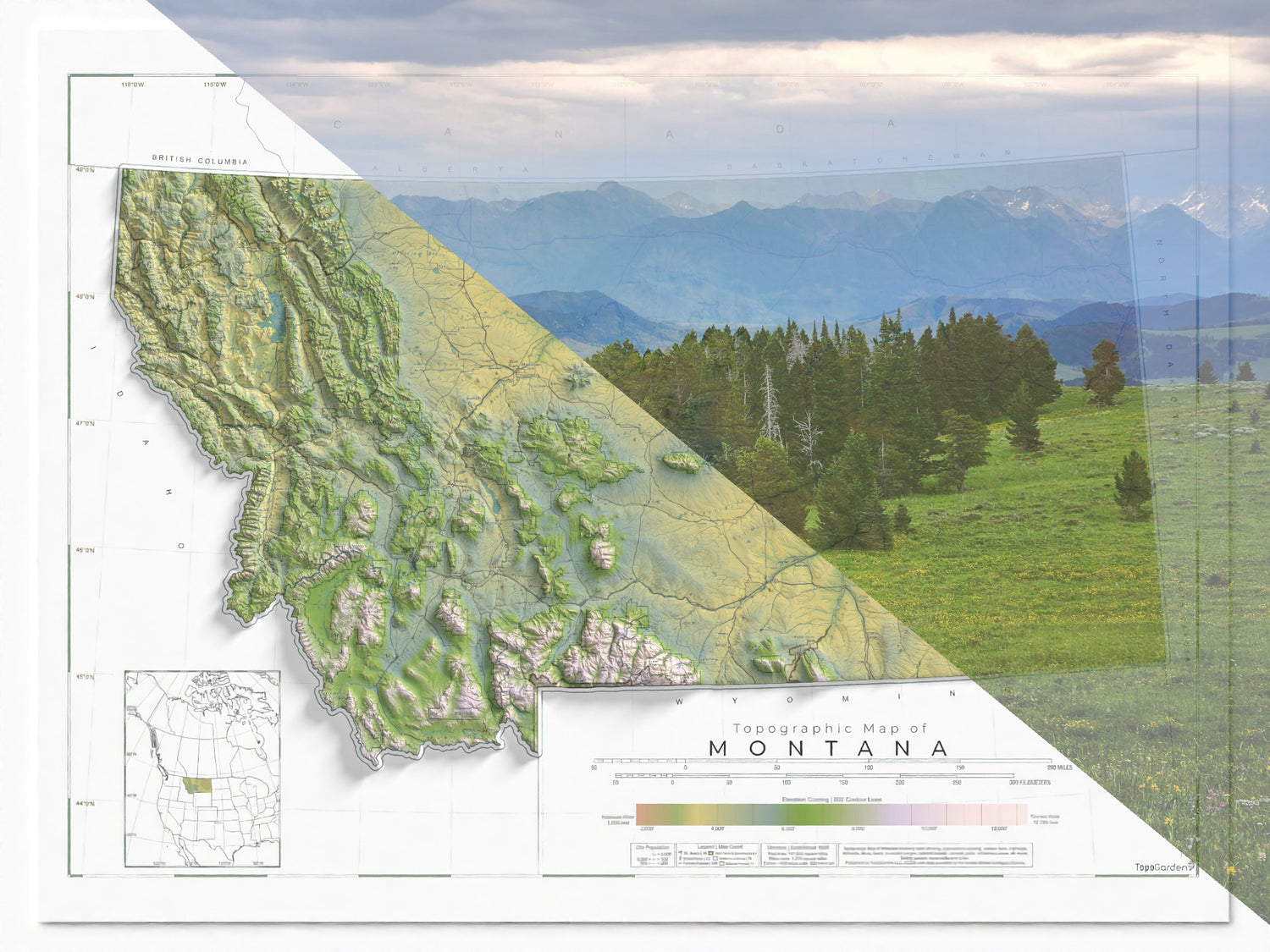
Please note: While relief shading gives some of our maps a raised, 3D effect, the maps are flat and two-dimensional. Order a larger size for optimal clarity / legibility.


Let customers speak for us

I was able to obtain a large customized Montana map. Todd worked with me and added additional labeling to his existing Montana map. This all was done at a reasonable price and I love the finished product. Thank you Todd!
I want a custom map and Todd has been super responsive and helpful in the planning process. I will update when I get my actual map but so far I am very impressed with our interactions.

Map made an awesome gift for christmas

Perfect map for the Montana angler!

This relief map allows a new perspective to our Tucson home. Our mountains are breathtaking and the map helps us to better orient ourselves to what we can see. The frame is a nice touch.

Love the map we chose and super happy we went with the frame as well. Looks absolutely amazing and did not have to wait for it long at all! Highly recommended

This map is absolutely stunning to look at in person. It is extremely intricate and the attention to detail is amazing. I would highly recommend any of these maps and will definitely be getting another one in the future.

Todd with TopoGarden made a map for my new home in Central Oregon. It is an amazing piece that I framed and displayed on a wall in my office. The detail and intricacy in his design makes the piece pop. I can’t recommend their work enough!

As a Montana Native, having this keepsake while I’m living out of state brings a bit of the Big Sky into my home. The detail is spot on and is a visual stunner. Couldn’t be more happy with it.
Such a cool shading and depiction of the area in Tucson! Love it!!
High-Quality Topographic Maps for Outdoor Enthusiasts
Incredible Detail: Each map features vibrant colors, precise shading, and intricate features that bring each landscape to life.
Premium Quality Prints: Thick museum quality cotton paper with precise, detailed Giclée printing. These fine art prints can last 100+ years.
Professional Framing: Ready to hang, solid wood frames with ultra clear acrylic glaze. The prints are mounted to foamboard to minimize warping. The dust cover and optional mat board border protect the print.
Enhance Your Space: Our maps are perfect for education, design, and inspiration, combining accurate detail with timeless aesthetic to spark curiosity, enhance knowledge and stoke inspiration.
Foster Connection: Whether for personal enjoyment or as a thoughtful gift, our maps offer a unique blend of beauty and meaning that’s perfect for any occasion.
Map Art Created In The Rocky Mountains
Located in Montana, USA, we create and refine maps to spark inspiration and provide education.
Printed with Museum Quality Materials and Inks
Our maps are produced with Giclée ("zee-clay") printing, combining rich archival inks and high-quality materials for unmatched durability and style.
Printed on thick, luxurious 100% cotton or premium archival matte paper.
Gallery Quality Wood Frames with Optical Grade Glazing
Solid pine frames, 1" white mat border, optical grade shatter resistant acrylic glazing, print mounted on foam to reduce warping, saw tooth hanger for easy installation.
Paper backing and matboard spacer included for maximum longevity and protection.